Details for mapping the back 5
In the age of Google Maps, it’s easy to believe in a singular, always-true map. We can easily pull up a map on our phones for anywhere in the world, so it’s easy to forget how many different photos, stories, and perspectives have gone into making that map. Agreeing on a single, shared map is efficient and useful for applications like collecting biological data over a long period of time, or finding the fastest bus route to the Leach Botanical Garden. However, so much is lost when all the various conflicting data are compiled into the illusion of a single, authoritative map.
As more users get involved with the Back 5, we need to update the tools we use to navigate, study, and experience the space. Maps are a particularly powerful tool to share information about the space.
In 2024, we decided to develop an updated series of maps of the Back 5. We partnered with geography students at Portland Community College to consider:
- Who decides what goes into the maps that we use?
- How do we highlight the many experiences and perspectives of the people who use the space?
- How can we use the need for a map as an educational opportunity?
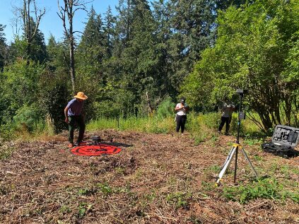
A team of students and faculty from the PCC Geography department collect drone data in the Back 5 on a sunny morning in August.
In August 2024, the PCC Geography team visited to fly image-collecting drones over the Back 5. This was an opportunity for PCC students to get real-world experience and for the Back 5 to get great quality data. Drone aerial imagery and data offers far more insight than a Google maps satellite image. These high-resolution maps provide us information about vegetation health, tree canopy density, and topography.
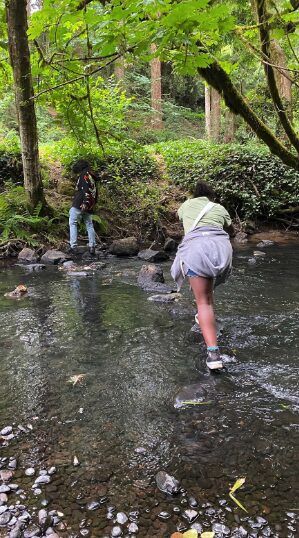
One of the primary needs for the Back 5 map was to mark trail networks. Blueprint Foundation students and the PCC group teamed up to map out these networks. Students came out and slowly walked the lengths of the many paths and trails in the Back 5, using GPS devices to record each trail segment. These trails were integrated with our existing maps and new drone data. Students gained experience with mapping tools, and the Back 5 got a base map of our trail system.
Our partners at PCC then used this basic map to invite other groups into the map-making process. We had wanted our new Back 5 map to show the various zones of the space. The Back 5 contains meadows, mixed conifer trees, and riverside plant communities. There are forested paths to walk by the creek, shady spots to sit and rest, and sunny berry patches to enjoy in the summer. There are as many ways to separate and categorize these different areas as there are people who use the space. We didn’t want to name and separate out these spaces from only one perspective, like a Google map.
Blueprint students chart out a creative path in the Back 5
Instead, we printed a simplified Back 5 map with marked trails, no names of areas, and a list of questions. Groups went into the Back 5 with this paper, a clipboard, a pen, and their own perspective. They came back with cartographic contributions based on their responses to questions like:
- What is a particular smell you notice?
- Where would you like to spend a whole afternoon?
- What is a space you are particularly proud of having worked in?
PCC integrated the data into maps which are publicly available and can be seen below.
DDHS Zone Interview
In November 2024, we invited David Douglas High School students to contribute to our map. They went out in small groups and added their inputs to the map, using trail markers as reference points on the map. The students were particularly enthusiastic about noticing some powerful smells in the area. You can explore the map to see what they smelled, along with other answers!
Volunteer Zone Interview
In December 2024, we led another community mapping session with Back 5 volunteers. Many of these volunteers have been working with the Back 5 project since it began five years ago. We changed the questions slightly. Explore the map to see their unique and valuable insights.
Each of our mapping exercises position the students and participants as the experts and map-makers of the space. Their experience and perspective directly contributes to the Back 5 and its maps. Plus, the process invites the participants to engage deeply with the space and strengthen a sense of personal belonging. We will continue collecting data from a variety of users and stakeholders of the restoration project. As the Back 5 continues to grow and change, we expect the map to follow suit.
Soon we will be opening up options for the public to participate in our place-making processes. We hope you will join us then!
Special thanks to:
- Natalie Ramsland, Lorena Nascimiento, Krishna Sunglieng, and the rest of the GIS team at PCC
- All the Blueprint and DDHS students who made this possible
- The many dedicated Back 5 volunteers for all their hard work
- All the Back 5 partners!

